DESIGN for RESILIENCE
Space-based Information and GeoAI for Climate Action and Disaster Risk Reduction
Learn more
Disaster Risk Reduction
Disasters are serious disruptions to the functioning of a community that exceed its capacity to cope using its own resources. Disasters can be caused by natural, man-made and technological hazards, plus factors that influence the exposure and vulnerability of a community.
More..
Critical Infrastructure Protection
One of the many advantages of GIS, is the creation of a visual database with many data layers from numerous sources which can be used and shared with others. It facilitates a multidisciplinary collaborative approach from the start of the project.
More..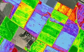
Environmental Management
The environment is a crucial part of our lives. Our climate is changing, and we are experiencing horrible weather patterns. Crops are dying because we cannot predict the weather. The world has worked hard to address these problems, but there is still more to do.
More..